
Geospatial Data Explained for Smarter Location Insights
Understanding Geospatial Data
Geospatial data refers to information that describes the physical location and characteristics of objects on Earth. Unlike traditional data, Geospatial data carries a geographic component, allowing businesses, governments, and researchers to analyze patterns and relationships in a spatial context. This type of data is crucial for understanding not only where things are but also how they interact with their surroundings.
Geospatial data can take various forms, including points, lines, polygons, and raster data. Point data represents specific locations, such as a retail store or a weather station. Line data can denote roads, rivers, or pipelines, while polygon data captures areas like city boundaries or land parcels. Raster data, on the other hand, represents information in a grid format, such as satellite imagery or digital elevation models.
The Importance of Geospatial Data
The growing demand for smarter decision-making in business and governance has amplified the importance of geospatial data. By combining location-based information with other datasets, organizations can uncover insights that would remain hidden in traditional databases. This empowers stakeholders to make informed decisions, optimize operations, and anticipate challenges.
For instance, urban planners can use geospatial data to monitor traffic congestion, identify optimal locations for public services, and plan infrastructure expansion. Similarly, retailers can leverage geospatial insights to understand customer distribution, optimize supply chains, and enhance market segmentation strategies. In essence, geospatial data transforms raw information into actionable intelligence.
Types of Geospatial Data
Vector Data
Vector data is one of the primary types of geospatial data and represents features in discrete geometric forms such as points, lines, and polygons. Each vector element can store attributes that describe its properties, making it highly suitable for applications like mapping and spatial analysis.
Raster Data
Raster data represents continuous surfaces and is typically used for imagery, terrain models, and remote sensing applications. Unlike vector data, raster data stores information in grid cells, each with a specific value representing a phenomenon like temperature, elevation, or vegetation density.
Attribute Data
Attribute data complements spatial data by providing descriptive information about specific locations or features. For example, a dataset representing schools might include attributes such as student population, school type, and performance scores. Combining spatial and attribute data allows for more comprehensive geospatial analysis.
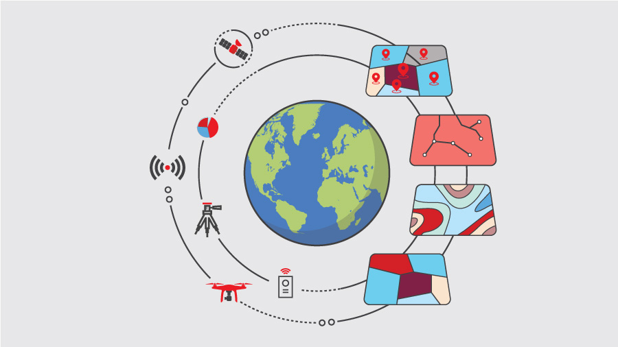
How Geospatial Data is Collected
Remote Sensing
Remote sensing involves capturing data about the Earth from a distance, often using satellites or aerial platforms. This method provides high-resolution imagery and environmental data, enabling applications in agriculture, forestry, and climate monitoring.
GPS and Location-Based Devices
Global Positioning System (GPS) technology has revolutionized geospatial data collection. GPS-enabled devices, from smartphones to autonomous vehicles, generate precise location data in real time, which can then be analyzed for various purposes such as logistics optimization, navigation, and geofencing.
Surveys and Field Data Collection
Traditional surveying and field data collection methods remain essential for acquiring accurate geospatial data, especially for infrastructure projects, cadastral mapping, and environmental assessments. Modern tools like drones and mobile GIS applications have further enhanced the speed and accuracy of these processes.
Applications of Geospatial Data
Urban Planning and Smart Cities
Geospatial data is instrumental in creating smart cities. By analyzing spatial information, urban planners can optimize traffic flow, monitor energy usage, and design sustainable infrastructure. GIS platforms allow municipalities to integrate data from multiple sources to improve decision-making and resource allocation.
Environmental Monitoring
Environmental agencies use geospatial data to track climate change, monitor deforestation, and manage natural resources. Satellite imagery and remote sensing data provide a continuous view of environmental changes, enabling timely interventions and policy development.
Business Intelligence
Companies leverage geospatial data to gain competitive advantages. Location intelligence helps in site selection, customer segmentation, and market analysis. Retail chains, logistics companies, and real estate firms rely heavily on geospatial insights to drive growth and efficiency.
Disaster Management
Geospatial data enhances disaster preparedness and response. Real-time mapping of hazards like floods, earthquakes, and wildfires allows authorities to coordinate relief efforts, allocate resources efficiently, and reduce potential losses.
Analytical Techniques for Geospatial Data
Spatial Analysis
Spatial analysis examines the relationships between geographic features. Techniques such as buffering, overlay analysis, and proximity analysis enable organizations to understand patterns, detect trends, and make predictive decisions.
Geostatistical Modeling
Geostatistical modeling uses statistical methods to interpret geospatial data. By identifying correlations and spatial variability, analysts can generate predictive models for applications like resource estimation, environmental risk assessment, and public health planning.
Machine Learning and AI Integration
Machine learning algorithms and AI techniques are increasingly applied to geospatial data. From predictive analytics to anomaly detection, AI enhances the accuracy and efficiency of spatial decision-making. For example, AI-powered models can analyze traffic patterns to optimize urban mobility or predict environmental hazards.
Tools for Geospatial Data Management
Geographic Information Systems (GIS)
GIS platforms are central to managing, analyzing, and visualizing geospatial data. These systems enable users to integrate spatial and attribute data, create interactive maps, and perform complex spatial queries. Popular GIS software includes ArcGIS, QGIS, and MapInfo.
Remote Sensing Software
Specialized software tools process imagery and sensor data collected from satellites, drones, or aircraft. These tools allow users to extract valuable information such as land cover classification, vegetation indices, and topographical changes.
Big Data and Cloud Solutions
The proliferation of geospatial data requires scalable storage and processing solutions. Cloud-based platforms and big data technologies allow organizations to store massive datasets, perform real-time analysis, and collaborate across teams efficiently.
Visualization and Interpretation
Interactive Mapping
Interactive maps enable stakeholders to explore geospatial data dynamically. Tools like web-based GIS dashboards provide real-time visualization, layering of multiple datasets, and intuitive user interfaces for deeper insights.
Heat Maps and Thematic Mapping
Heat maps and thematic maps highlight patterns and trends within geospatial data. These visualizations simplify complex information, making it easier for decision-makers to identify hotspots, resource distributions, and areas of concern.
3D and Augmented Reality Applications
Advanced visualization techniques, including 3D modeling and augmented reality (AR), offer immersive experiences for geospatial analysis. Urban planners, architects, and environmental scientists use these methods to simulate scenarios, assess impacts, and communicate findings effectively.
Challenges in Geospatial Data Utilization
Data Accuracy and Quality
Ensuring the accuracy and quality of geospatial data is critical. Inaccurate or outdated data can lead to flawed analyses and poor decision-making. Continuous validation, verification, and updating are necessary to maintain reliability.
Privacy and Security Concerns
Geospatial data often includes sensitive information, making privacy and security paramount. Organizations must adhere to legal and ethical standards while implementing robust data protection measures to safeguard user information.
Integration with Other Data Sources
Combining geospatial data with other datasets, such as demographic or transactional information, can be complex. Ensuring compatibility, consistency, and interoperability across platforms is essential for meaningful insights.
Future Prospects of Geospatial Data
AI-Enhanced Location Intelligence
Artificial intelligence will continue to revolutionize geospatial data analysis. Predictive modeling, automated pattern recognition, and intelligent decision support systems will enhance the value of location insights across industries.
Real-Time Geospatial Analytics
The demand for real-time geospatial data is rising. Advances in sensor technology, IoT devices, and high-speed data processing will enable instant analysis, crucial for applications like traffic management, emergency response, and smart infrastructure.
Expanding Industry Applications
Geospatial data will increasingly drive innovation across sectors, including healthcare, agriculture, logistics, and energy. As more organizations adopt location-based strategies, the integration of geospatial insights will become a core component of digital transformation.
Conclusion
Geospatial data has emerged as a transformative resource for modern organizations, offering unparalleled insights into spatial relationships and patterns. By understanding the types, applications, and analytical techniques of geospatial data, businesses and governments can optimize operations, enhance decision-making, and drive innovation. As technology continues to evolve, leveraging geospatial data will become an indispensable strategy for smarter, location-driven intelligence.
Geospatial data empowers organizations to move beyond traditional analytics, enabling predictive modeling, real-time monitoring, and immersive visualization. From urban planning to business intelligence, its applications are vast and continually expanding. Embracing geospatial data is not just about understanding locations—it’s about unlocking the full potential of spatial insights to make informed, strategic, and impactful decisions.